BERLIN—The Intergeo 2023 conference here featured a number of geospatial product rollouts and even a few deals. Topcon Positioning Systems and SOCOTEC have announced an agreement for Topcon to provide monitoring technology to SOCOTEC throughout Europe.
The deal includes monitoring technology for infrastructure projects in France, the Netherlands, Spain, and in the United Kingdom, the company said.
SOCOTEC, a testing, inspection and certification (TIC) company with more than 200,000 clients in 26 countries, will employ Topcon robotic total stations from the MS Measuring Station series and several additional geopositioning portfolio resources, the company said. The products will include total stations, GNSS, and third-party geotechnical sensors, which are powered via Delta Link hardware and monitored through its software, the company said.
At Intergeo, Topcon exhibited its Hybrid Positioning system, Delta deformation monitoring solutions, and real-time network correction service, Topnet Live, among others. The company also exhibited its recently unveiled Aptix integration platform as part of its European debut, the company said.

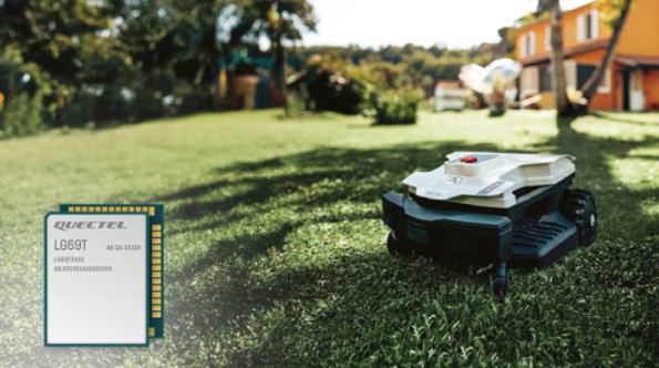
Also at the conference, Quectel Wireless said that Zucchetti Centro Sistemi (ZCS) will integrate the company’s LG69T-AM GNSS module into their robotic lawnmowers. The lawnmowers will feature the ZCS Cloud real-time kinematic (RTK) technology, primarily for larger gardens.
Quectel also announced that, with IoT company MikroElektronika, it has launched the LC29H series RTK Click Boards. The LC29H is a series of dual-band, GNSS modules that are based on the latest L1/L5 receiver that have equivalent accuracy to existing L1/L2 receivers, but with 70 percent less power consumption and 50 percent smaller, the company said.
Intergeo, known for years as a high-precision survey show, has become a showcase for autonomous machinery, Vehicle to Anything (V2X), and particularly, UAVs. China-based DJI Enterprise rolled out its Zenmuse L2 drone lidar, which the company says has expanded range and more accuracy.
In other Intergeo News:

- Phase One rolled out its PAS Pana that offers countrywide area mapping. PAS Pana is a seven-camera, wide-field system for aerial mapping
- Hexagon Geosystems won the Wichmann Innovations Award at Intergeo. The company won in two categories—hardware and software.
- This year’s conference featured 17,000 trade visitors from 112 nations, 571 exhibitors from more than 40 countries, more than 300 speakers and 841 conference participants from 42 countries, according to show organizers.


